Old City Map - Coney Island New York Landowner - 1880 - This is an exquisite full-color Reproduction printed on high-quality gloss paper, art paper or canvas.
Print Size: 23.00 x 35.88 inches
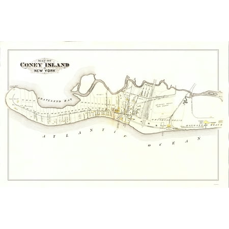
Sites and Townships Specific To This Map Are: Showing New York & Coney Island Railroad, New York & Sea Bech Railroad, Gravesend Bay, The Point, Coney Island Creek, Manhattan Beach, Brighton Beach, Brighton Beach Race Course, Ocean Parkway Blvd, Ocean Hotel & Many Named Landowners.
The following towns are featured: Coney Island.
This Map is Situated in: Brooklyn Borough.
SKU: NYCO0001
Original Maps are often difficult to find and usually have fold lines, identifying stamps or markings, tears, ragged edges, and assorted other natural signs of age that detract from their beauty. All of our maps have been professionally restored to depict their original beauty, while keeping all historical data intact.
These maps are fabulous pieces of history full of information useful to Historians, Genealogists, Cartographers, Relic Hunters, & Others. They make fascinating conversation pieces and splendid works of art for the home or office.
Landowner Map
This extremely difficult to obtain map, referred to as a "Land Ownership" map is a rare commodity. It is entitled a "Land Ownership" map because it indicates the original land owner plot number and many times their names.
Shipping: Your artwork is rolled for shipping

| Features | Giclee Printing |
| Brand | Maps of the Past |
| Home Decor Style | Vintage |
| Theme | Historic Maps |
0 comments:
Post a Comment